Instructions:
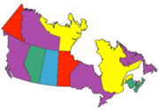
Check the provinces that you have visited, select a map size, then click Draw Map to create your own customized map of visited provinces. Then upload your customized visited provinces map to your own website, Facebook or Instagram.
Use this free mapping tool to display the Canadian provinces that you have visited, driven or ridden through. RV drivers, motorcycle riders, car touring enthusiasts: Create a color province map to show where you have travelled.

Brought to you by Programmer/Musician Les Brown.
Listen: Les Brown on Apple Music
|
Les Brown on Spotify